Alchemist is equipped with the ability to load and simulate on real-world maps. Navigation on maps can be done by using gps traces, by moving along roads (Alchemist relies on GraphHopper to provide directions), by interpolating gps traces with on-the-road-movements, or by ignoring the map information on just move as you would in a continuous space.
Setting up a map environment
In order to run simulations on real world maps, an appropriate environment must be selected.
Currently, the only environment supporting maps is OSMEnvironment.
The only mandatory parameter is the path of the file with the map to be loaded. Accepts OSM maps of any format (xml, osm, pbf).
Is possible define other optional parameter like:
approximation: Int-> the amount of ciphers of the IEEE 754 encoded position that may be discarded when comparing two positions, allowing a quicker retrieval of the route between two position, since the cache may already contain a similar route which can be considered to be the same route, according to the level of precision determined by this valueonStreets: Boolean-> if true, the nodes will be placed on the street nearest to the desired positiononlyOnStreets: Boolean-> if true, the nodes which are too far from a street will be simply discarded. If false, they will be placed anyway, in the original position
The following example shows how to configure a simulation that loads data from an Openstreetmap file
(OSM, XML and PBF formats are supported) located in the classpath folder maps:
incarnation: protelis
environment:
  type: OSMEnvironment
  parameters: [maps/foo.pbf]
Using GPS traces to deploy nodes
GPS traces can be used to deploy nodes on a map.
In order to set the initial position of the nodes with the first position of the GPS traces,
you need to use the deployment FromGPSTrace.
The deployment FromGPSTrace require the following parameters:
- number of nodes to deploy
- file with the GPS traces to use
- boolean that indicates if the list of GPS trace is cyclic.
If
trueand the GPS traces are less than the number of nodes to be deployed, then the traces are cyclically re-used to deploy nodes. - a GPSTimeAlignment to define how to align the time of all the GPS points of all GPS traces. There are present several strategy in the package it.unibo.alchemist.boundary.gpsload.api and introduced in the following subsection.
The following example places 1497 nodes with the first position of the GPS traces in the file vcmuser.gpx.
The list of GPS traces isn't cyclic.
The strategy to align time of all the GPS points is AlignTime
in order to consider only the GPS points with attribute time greater than the specified one
(in milliseconds from epoch).
deployments:
  - in:
      type: FromGPSTrace
      parameters: [1497, "vcmuser.gpx", false, "AlignToTime", 1365922800, false, false]
Strategy to align time of GPS trace
The strategies available to align time of GPS trace are the following:
- NoAlignment -> No alignment is performed.
- AlignToFirstTrace -> Aligns all traces at the start time of the first trace.
If you have two traces, the first trace start with time = 2 and second point with time = 5,
the second trace start with time = 4 and second point with time = 6,
the result will be:
- first trace -> start with time = 0 and second point with time = 3
- second trace -> start with time = 2 and second point with time = 4
- AlignToSimulationTime -> Aligns all traces at the initial simulation time.
If you have two traces, the first trace start with time = 2 and second point with time = 5,
the second trace start with time = 4 and second point with time = 6,
the result will be:
- first trace -> start with time = 0 and second point with time = 3
- second trace -> start with time = 0 and second point with time = 2
- AlignToTime -> Aligns the traces with the given time in seconds from Epoch.
All points before such time will be discarded. All points after the provided time will
be shifted back.
If you have two traces, the first trace start with time = 2 and second point with time = 5,
the second trace start with time = 4 and second point with time = 6, the given time is 3
the result will be:
- first trace -> first point discarded and second point with time = 2
- second trace -> start with time = 1 and second point with time = 3
Navigation
As previous say there are several behavior in order to move the nodes in a environment with real-word map:
-
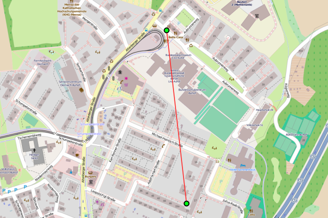
movement ignoring map information. A node move directly from start position to destination position:
-
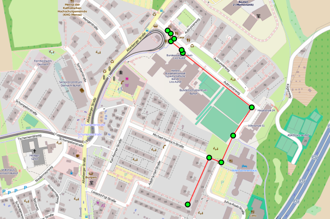
movement by using map information. A node move from start position to destination position using intermediate position in order to follow streets and avoid obstacle (like building):
-
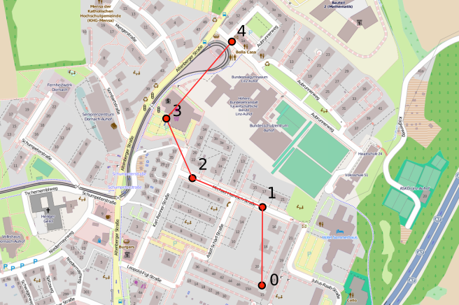
movement by reproducing a GPS trace (action ReproduceGPSTrace). A node start to the first position of the GPS trace, than move to the next position of the trace until arrive to the last. The movement from a position to another is direct with a straight line:
-
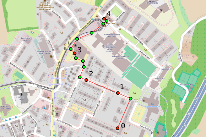
movement by interpolating the GPS trace with street data (action GPSTraceWalker). A node start to the first position of the GPS trace, than move to the next position of the trace until arrive to the last. The movement from a position to another use map information to define intermediate position in order to follow streets and avoid obstacle (like building):
Both the actions ReproduceGPSTrace and GPSTraceWalker require:
0. the file with the GPS traces
0. a boolean that indicate if the list of GPS trace is cyclic
0. the strategy to align the attribute time of the GPS points of the GPS traces
The following example show how it is possible define a program to follow GPS traces.
programs:
  - time-distribution: 0.1
  type: Event
  actions:
    - type: ReproduceGPSTrace
      parameters: ["/vcmuser.gpx", false, "AlignToTime", 1365922800, false, false]